Tham Fossil - MH0258
19.589862,98.245946
Location
South of the dirt track between Ban Tham Lod and Ban Huai Haeng. 4 km from Ban Tham Nua take a side track on the left for 500 m to a group of huts on a ridge. From here a walking trail leads southwest around the sides of two dolines, crosses over the saddle between two prominent limestone outcrops then descends through thick forest to a third doline 1 km from the huts. The cave entrance is 30 m south of the path close to the northeast corner of the doline.
Description
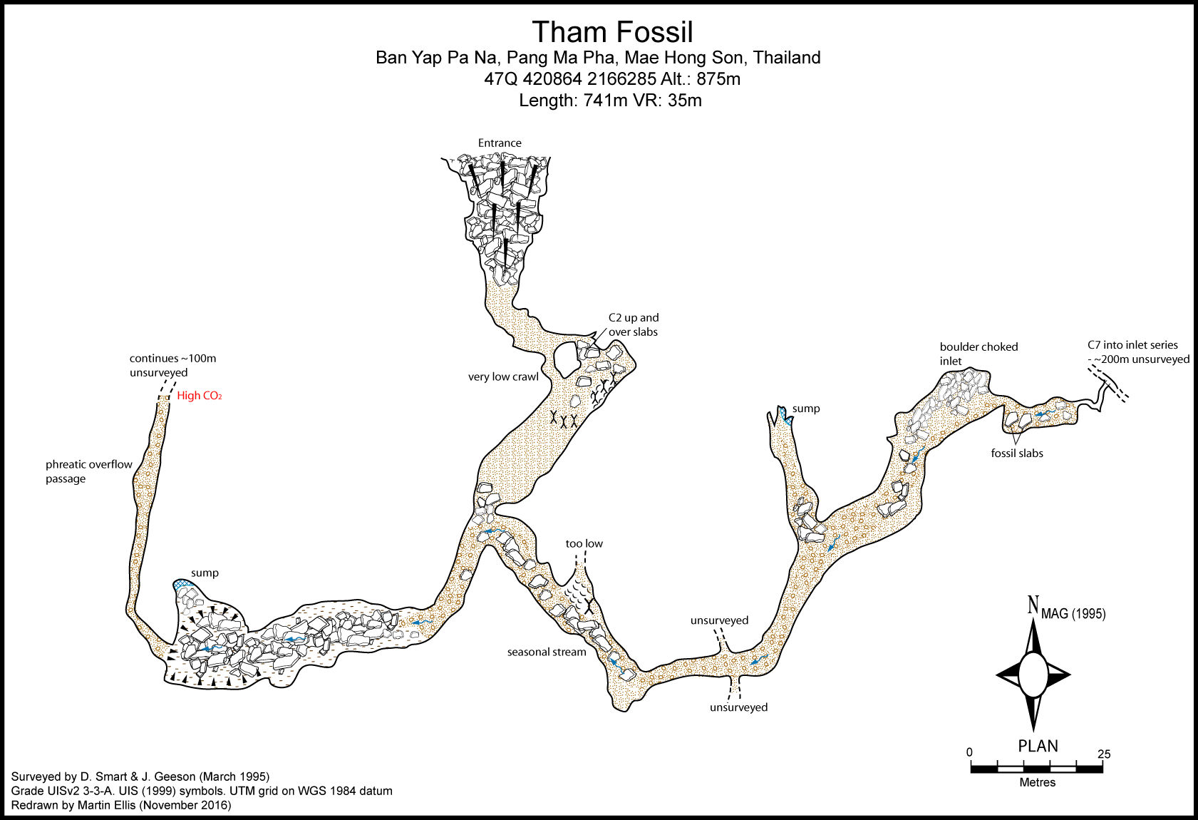
The 20m wide triangular shaped entrance leads to either a narrow squeeze or a 2m climb over boulders into a beautifully decorated chamber with very clear rock bedding planes. At the far end of the chamber the cave narrows to a seasonal stream passage with large angular boulders. After 100m the cave reaches a T junction. The right branch contains high CO2 levels, but the left branch can be followed along an easy gravel bed for another 100m to some rock slabs with excellent examples of brachipod fossils. Beyond the fossils there is a 7m climb down into an inlet series. This is estimated to be 200m long, but has not been surveyed.
Topography
Smart & Geeson March 1995 - BCRA Grade 5c SMART, DEAN (1995d) "World Record Stal" Descent No. 125 p19 - BCRA 5c SIDISUNTHORN, PINDAR; GARDNER, SIMON; SMART, DEAN (2006)
Documents
Bibliography 01/07/2020- +ANZANELLO, EZIO; CADAMURO, MARIAGRAZIA (1996) "Tham X e Altre Grotte" Speleologia Venata N.s. Vol. 4. pp94-95 +DE VOOGD, OTTO (2005) "Tham Lod" www.infohub.com/forums +DILOKWANICH, S.; ET AL. (2000) "An Exploration and Database System of the Caves, Mae Hong Son Province" 6 Vols. Faculty of Environment and Resource Studies, Mahidol University, Bangkok +DUNKLEY, JOHN ROBERT (1997) "The Caves of Thailand - Addendum 1995-97" Speleological Research Council, Sydney +FOAKES, MARTIN (1998) "Caving in North-West Thailand" International Caver No. 22 pp32-35 +SMART, DEAN (1995d) "World Record Stal" Descent No. 125 p19 +Weare, Robin (2014) "Mud maps and caves in Thailand" presentation at Hidden Earth 2014
Histoire
1990 First explored by the Australian expedition. 1995-05 D. Smart & J. Geeson surveyed cave. 2018 R. Gardner
Cavités proche
| Distance (km) | Nom | Longueur (m) | Profondeur (m) |
|---|---|---|---|
| 0.2 | Waterfall Cave [MH0260] | 500 | 20 |
| 0.2 | Resurgence MH0191 - MH0191 | ||
| 0.3 | Ha Ko - MH0011 | 172 | 0 |
| 0.5 | Cave MH0207 - MH0207 | 200 | 0 |
| 0.7 | Tham Sak Hoy - MH0206 | 150 | 0 |
| 0.7 | Tham Bendit 1 - MH0012 | 100 | 6 |
| 0.8 | Cave MH0213 - MH0213 | ||
| 0.8 | Cave MH0192 - MH0192 | 530 | 0 |
| 1.1 | Sink MH0313 |