Ha Ko - MH0011
(TH - ประเทศไทย)
19.592388,98.246955
19.592388,98.246955
Longueur 172m Profondeur 0m
Location
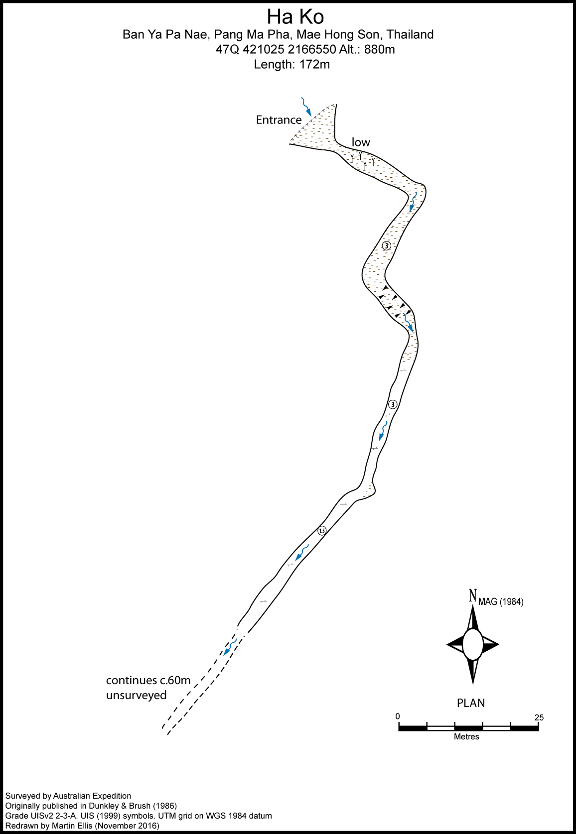
Ha Ko is the local Red Lahu name for the cave. The entrance is at the end of a 2 km long depression which in 1982 contained a field of opium poppies.
Description
The cave is part of the Ya Pa Nae stream system. A short scramble at the foot of an overhanging cliff opens into a 4m wide and 3m high passage between mud banks and muddy decoration suggesting extensive flooding. This gradually narrows to a bedrock crawl and eventually the passage becomes impassable. The cave was blocked when visited by the APS in 1985.
Topography
DUNKLEY, JOHN ROBERT; BRUSH, JOHN B. (ED.) (1986)
Documents
Bibliography 11/04/2020- DEHARVENG, LOUIS ET AL. (1986) "ExpÚdition Tha´-Maros 85" Association PyrÚnÚenne de SpÚlÚologie, Toulouse ISBN 2-906273-00-7 Dunkley, John Robert (1985a) "Karst and Caves of the Nam Lang - Nam Khong Region, North Thailand" Helictite Vol. 23 No. 1 pp3-22 DUNKLEY, JOHN ROBERT (1995) "The Caves of Thailand" Speleological Research Council, Sydney ISBN 0-9589253-9-9 DUNKLEY, JOHN ROBERT; BRUSH, JOHN B. (ED.) (1986) "Caves of North-west Thailand: Report of the Australian Speleological Expeditions 1983-1986" Speleological Research Council, Sydney ISBN 0-9589253-2-1
Cavités proche
| Distance (km) | Nom | Longueur (m) | Profondeur (m) |
|---|---|---|---|
| 0.3 | Tham Fossil - MH0258 | 741 | 35 |
| 0.4 | Cave MH0207 - MH0207 | 200 | 0 |
| 0.4 | Waterfall Cave [MH0260] | 500 | 20 |
| 0.5 | Tham Bendit 1 - MH0012 | 100 | 6 |
| 0.5 | Resurgence MH0191 - MH0191 | ||
| 0.5 | Tham Sak Hoy - MH0206 | 150 | 0 |
| 1.1 | Cave MH0192 - MH0192 | 530 | 0 |
| 1.1 | Cave MH0213 - MH0213 | ||
| 1.1 | Sink MH0313 |