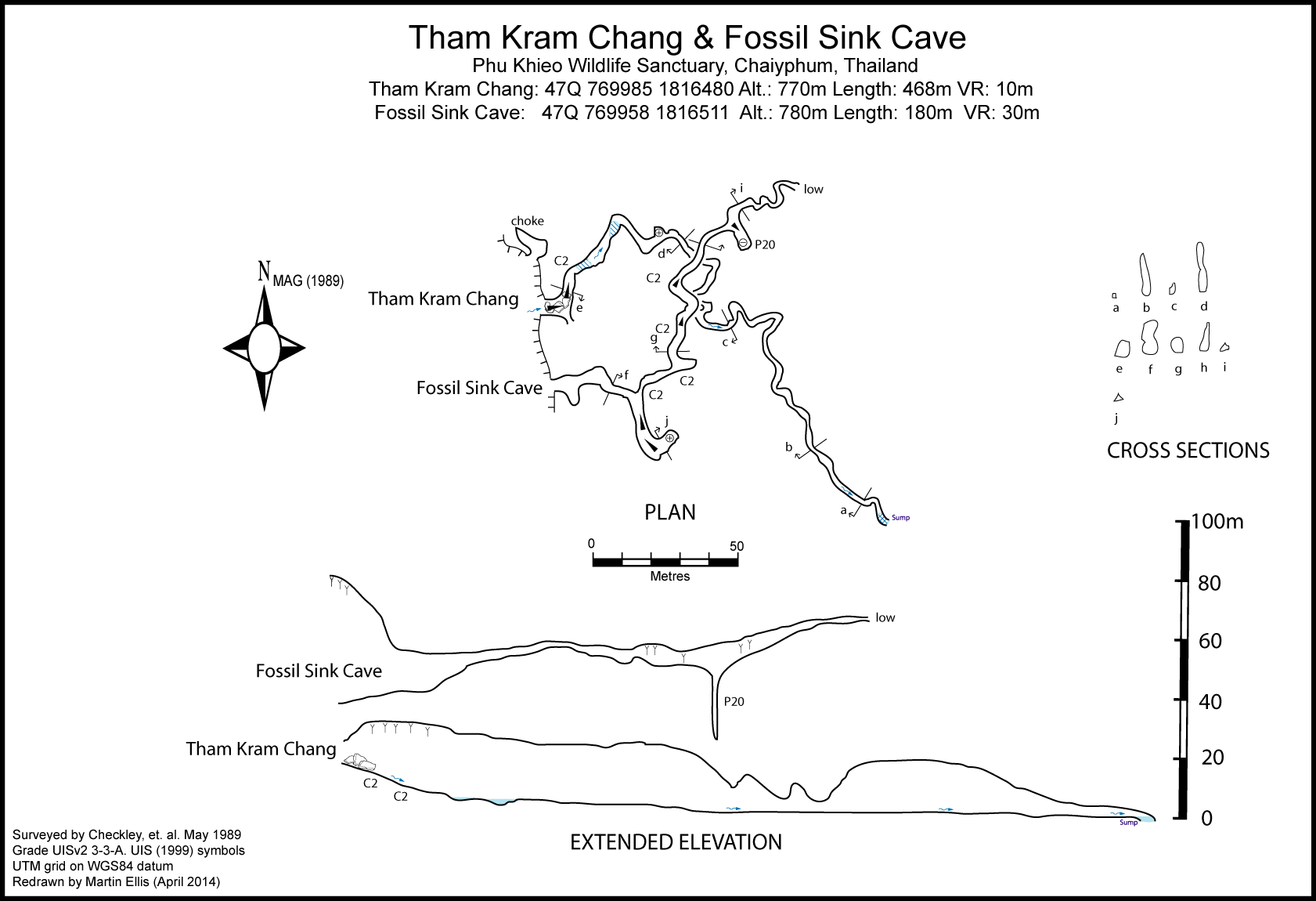
Tham Kram Chang [Elephant Tooth Cave] [CH0017]
16.414592,101.528009
Location
North-north-east of the Tham Nok Nang An camp used by the 1989 expedition there is a Y-shaped doline. This can be reached by following the gully upstream from the camp and after 1km taking the north-westerly fork for approximately 500m and then climbing the west ridge. The ridge top should be followed until a subsidary ridge runs westerly towards an obvious peak. Follow this until it begins to ascend and then drop steeply down the north side to the base of the doline and follow the stream down the gully to the entrance to Tham Kram Chang.
Description
This sink cave consists of fine vadose passage dropping down a series of short climbs to a 300m horizontal section which lowers to a sump. It seems likely that the water resurges in or flows beneath a large doline a kilometre to the south-west, before flowing towards the Lam Chi River area.
Topographie
CHECKLEY, DAVE; HURD, SHELIA; CHAPMAN, PHIL; JONES, HOWARD; WILLIS, DICK (n.d. [1989])
Documents
Bibliography 18/06/2019- CHECKLEY, DAVE; HURD, SHELIA; CHAPMAN, PHIL; JONES, HOWARD; WILLIS, DICK (n.d. [1989]) "Caves of the Phu Khieo Wildlife Sanctuary, North-East Thailand" Unpublished report DUNKLEY, JOHN ROBERT (1995) "The Caves of Thailand" Speleological Research Council, Sydney ISBN 0-9589253-9-9 124pp
History
The cave was explored in 1989 by a British expedition.
Caves nearby
| Distance (km) | Name | Length (m) | Depth (m) |
|---|---|---|---|
| 0.0 | Fossil Sink Cave - CH0018 | 180 | 30 |
| 1.7 | Tham Nok Nang An [Swallow Cave] [CH0019] | 907 | 71 |
| 2.4 | Tham Huai - CH0016 | 60 | 36 |
| 2.5 | Tham Huai Khwai [Huai Khwai Stream Sink] [CH0014] | 400 | |
| 3.0 | Tham Kon Dtai [Dead Man Cave] [CH0020] | 60 | 15 |
| 3.1 | Tham Phu Khieo - CH0021 | 2866 | 130 |
| 5.1 | Tham Huai Nam Lad [Tham Huai Khang Khao] [Small Waterfall Cave] [CH0023] | 674 | 125 |
| 5.2 | Huai Khao (Tham) [CH0024] | 581 | 20 |
| 5.3 | Tham Huai Chi Laeng [Cave of the Dry Stream] [CH0030] | 1602 | 60 |