Pawee Upper Cave (Tham)
20.816166,102.674500
Location
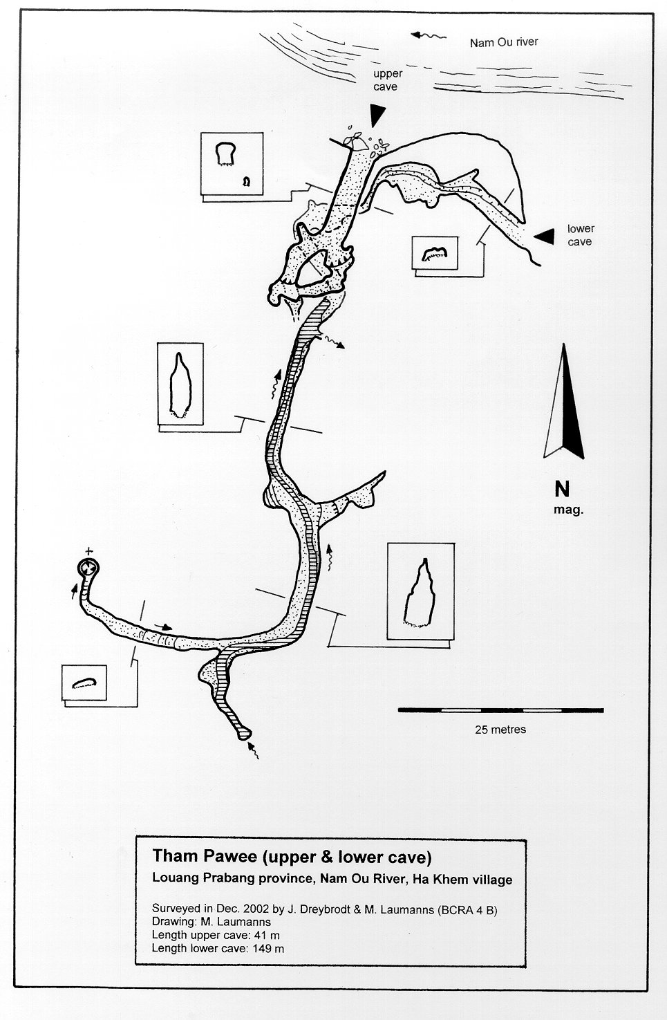
The cave is situated south of Halkham village about 75 minutes by boat upstream on the Nam Ou River from Ngoy Nua and is located in an isolated limestone cone immediately on the southern shore of the Nam Ou River. The limestone cone is very easy to recognise due to the fact that the Nam Ou leaves its gorge north of Sop Chem village to enter an area of jungle-covered smooth hills of generally non-calcareous rocks [5158] Map sheet: F48-110 Methode: from map
Description
DREYBRODT JOERG informations
Cave description: Citation: Analysis: [5158]: Upper Tham Pawee consists of a rift-controlled passage that has been enlarged by phreatic processes. The passage branches after a few metres to reconnect in an upper chamber where some dripstone formations can be found. The entrance gallery of Tham Pawee (Upper Cave) is covered with inscriptions in Lao and English >> survey >> shown on map Equipment: Remarks: References: [4846]: Dreybrodt, J. & Laumanns, M. 2003: Der unbekannte Norden von Laos - Ergebnisse eines Erkundungsprojekts. Mitt. Verb. Dt. Höhlen- und Karstforsch. 49 (2): 38-41. [4847]: Dreybrodt, J. & Laumanns, M. 2003: Northern Laos Christmas 2002. Expedition to Muang Ngoy & Luang Prabang, Lao PDR. Unpublished Report, 20pp. [5158]: Dreybrodt, J. & Laumanns, M. (eds.) 2005: The unknown North of Laos (Karst and Caves of the Provinces Luang Phrabang and Luang Nam Tha). Berliner Höhlenkundliche Berichte 16. 105 pp & Annex.
Cavités proche
| Distance (km) | Nom | Longueur (m) | Profondeur (m) |
|---|---|---|---|
| 0.0 | Pawee Lower Cave (Tham) | 0 | |
| 0.0 | Pachiau (Tham) | 0 | |
| 4.6 | Hoengu (Tham) | 0 | |
| 4.9 | Tham Viet | 0 | |
| 5.0 | Paman (Tham) | 0 | |
| 5.1 | Paho 1 (Tham) | 0 | |
| 5.1 | Paho 2 (Tham) | 0 | |
| 5.3 | Louang (Tham) | 0 | |
| 5.4 | Tham Paho 3 | 0 |