Cave NA0100
(TH - ประเทศไทย)
19.420730,101.069810
19.420730,101.069810
Longueur 14m Profondeur 326m
Location
The swallet is in a steep sided doline on the eastern side of a hill near the Security Development Project headquarters. The entrance can be accessed by either walking up the cabbage fields opposite the Security Development Project or by walking down from the sealed road which goes to Ban Mani Phruk 2
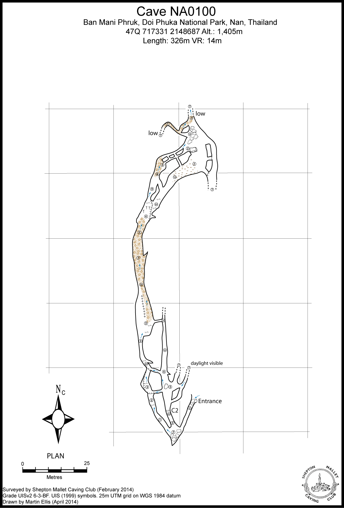
Description
Topographie
SMCC 19 February 2014 Grade UISv2 6-3-BF Ellis, Martin (2015b)
The cave consists of a streamway and a series of oxbow passages, with many links between these two parts to the cave. The streamway ends at a very low section that hasn't been pushed to a conclusion, but is the upstream end of the low duck seen in Cave NA0142. Some of the inlet passages in the oxbows have also not been pushed to a conclusion
Documents
[Topo] Cave NA0100 14/05/2019Bibliography 07/10/2020
- ELLIS, MARTIN (2012a) "Ban Mani Phruk Expedition 2012" Shepton Mallet Caving Club 39pp Ellis, Martin (2014b) "SMCC Nan 2014 expedition" www.thailandcaves.shepton.org.uk/smcc-nan-2014 Ellis, Martin (2014d) "Ban Mani Phruk Expedition 2014" Shepton Mallet Caving Club 53pp Ellis, Martin (2015b) "Ban Mani Phruk Expeditions 2012-2014, Nan, Thailand" Shepton Mallet Caving Club Journal Series 13 No. 4 pp146-185 Ellis, Martin (2015d) "Caves of Doi Phuka National Park" privately published, April 2015, 81pp
Cavités proche
| Distance (km) | Nom | Longueur (m) | Profondeur (m) |
|---|---|---|---|
| 0.2 | Cave NA0141 | 105 | 7 |
| 0.8 | Tham Nam Dan - NA0045 | 100 | 39 |
| 0.8 | Huai Nam Dan Sink - NA0046 | ||
| 1.0 | Shaft NA0071 - NA0071 | 26 | 20 |
| 1.1 | Sink NA0094 | ||
| 1.2 | Sink NA0093 | ||
| 1.4 | Tham Pha Phueng - NA0043 | 4750 | 476 |
| 1.4 | Shaft NA0070 - NA0070 | 8 | 8 |
| 1.5 | Sink NA0101 |