Pasang (Tham)
20.751333,102.664000
Location
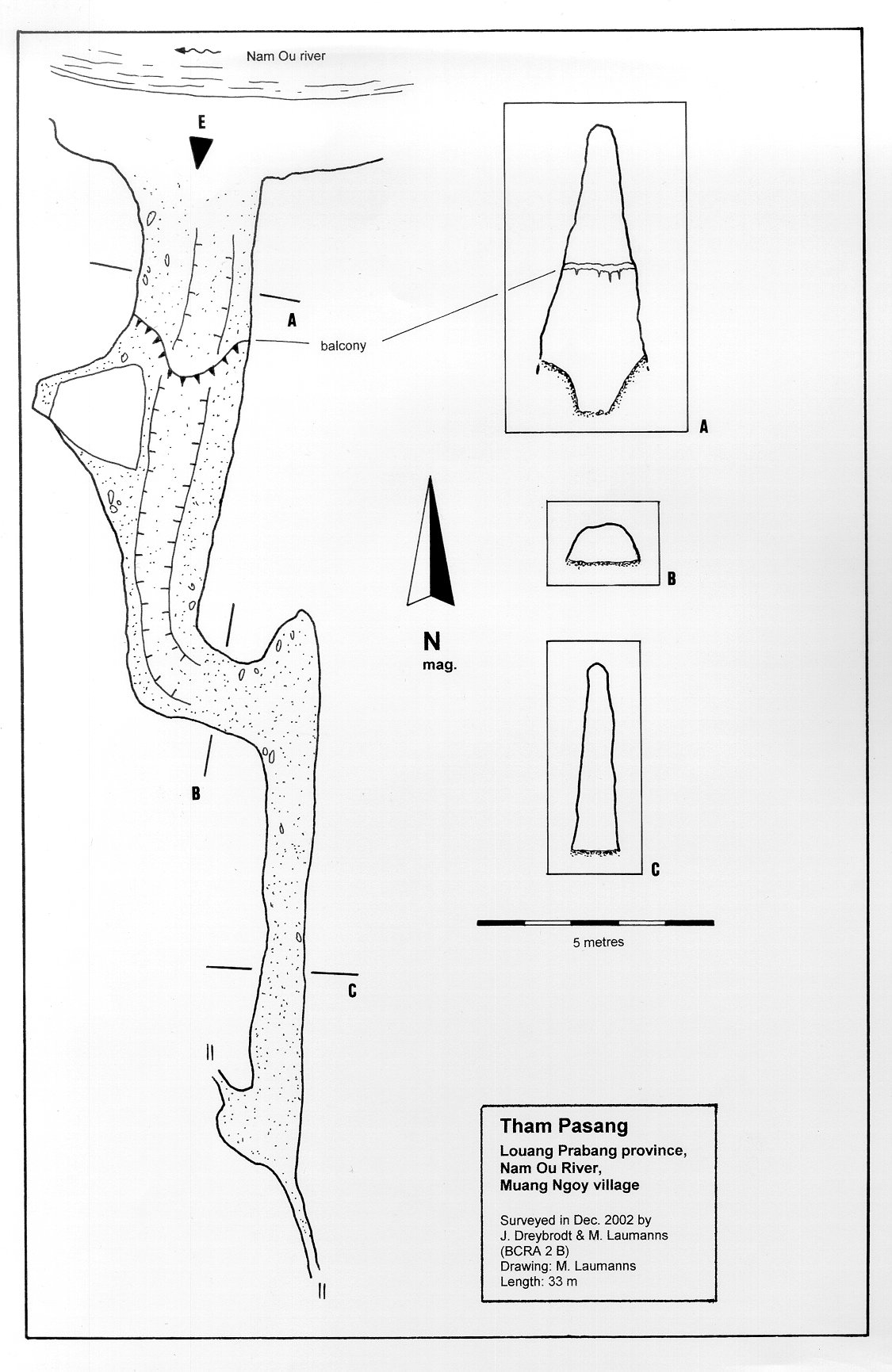
The cave is situated on the east shore of the Nam Ou River about 30 minutes by boat upstream from Ban (=village) Ngoy Nua. The entrance is easily visible from the river. [5158] Map sheet: F48-110 Methode: from map
Description
DREYBRODT JOERG informations
Cave description: ?? Citation: Analysis: [4847] (entrance pic) Entrance clearly visible, 6m high, 35 m wide. The entrance passage is oriented along the vertical bedding. It ends into a short crawl and continues into a parallel passage. The cave ends in an unpassable narrow claim filled crack. The entrance is used by fishers for overnight stays >> survey >> shown on map [5158]: The 15 m long entrance passage of the cave follows the vertical limestone beds. Where the gallery ends a low tube-shaped crawl leads to the left and meets another bedding plane that has been widened by phreatic solution. This passage ends after another 15 m in an impenetrable fissure filled with clay >> survey >> shown on map Equipment: During the Monsoon the cave is completely submerged by the rising Nam Ou River [5158] Remarks: References: [4846]: Dreybrodt, J. & Laumanns, M. 2003: Der unbekannte Norden von Laos - Ergebnisse eines Erkundungsprojekts. Mitt. Verb. Dt. Höhlen- und Karstforsch. 49 (2): 38-41. [4847]: Dreybrodt, J. & Laumanns, M. 2003: Northern Laos Christmas 2002. Expedition to Muang Ngoy & Luang Prabang, Lao PDR. Unpublished Report, 20pp. [5158]: Dreybrodt, J. & Laumanns, M. (eds.) 2005: The unknown North of Laos (Karst and Caves of the Provinces Luang Phrabang and Luang Nam Tha). Berliner Höhlenkundliche Berichte 16. 105 pp & Annex.
Cavités proche
| Distance (km) | Nom | Longueur (m) | Profondeur (m) |
|---|---|---|---|
| 1.4 | Doun (Tham) [Ban Ngoy Nua] | 0 | |
| 1.8 | Tham Doun Mai | 0 | |
| 2.6 | Tham Paho 3 | 0 | |
| 3.0 | Paho 1 (Tham) | 0 | |
| 3.0 | Paho 2 (Tham) | 0 | |
| 3.0 | Tham Viet | 0 | |
| 3.1 | Hoengu (Tham) | 0 | |
| 3.2 | Louang (Tham) | 0 | |
| 3.5 | Paman (Tham) | 0 |