Tatkeh 3 (Tham)
19.878361,102.088970
Location
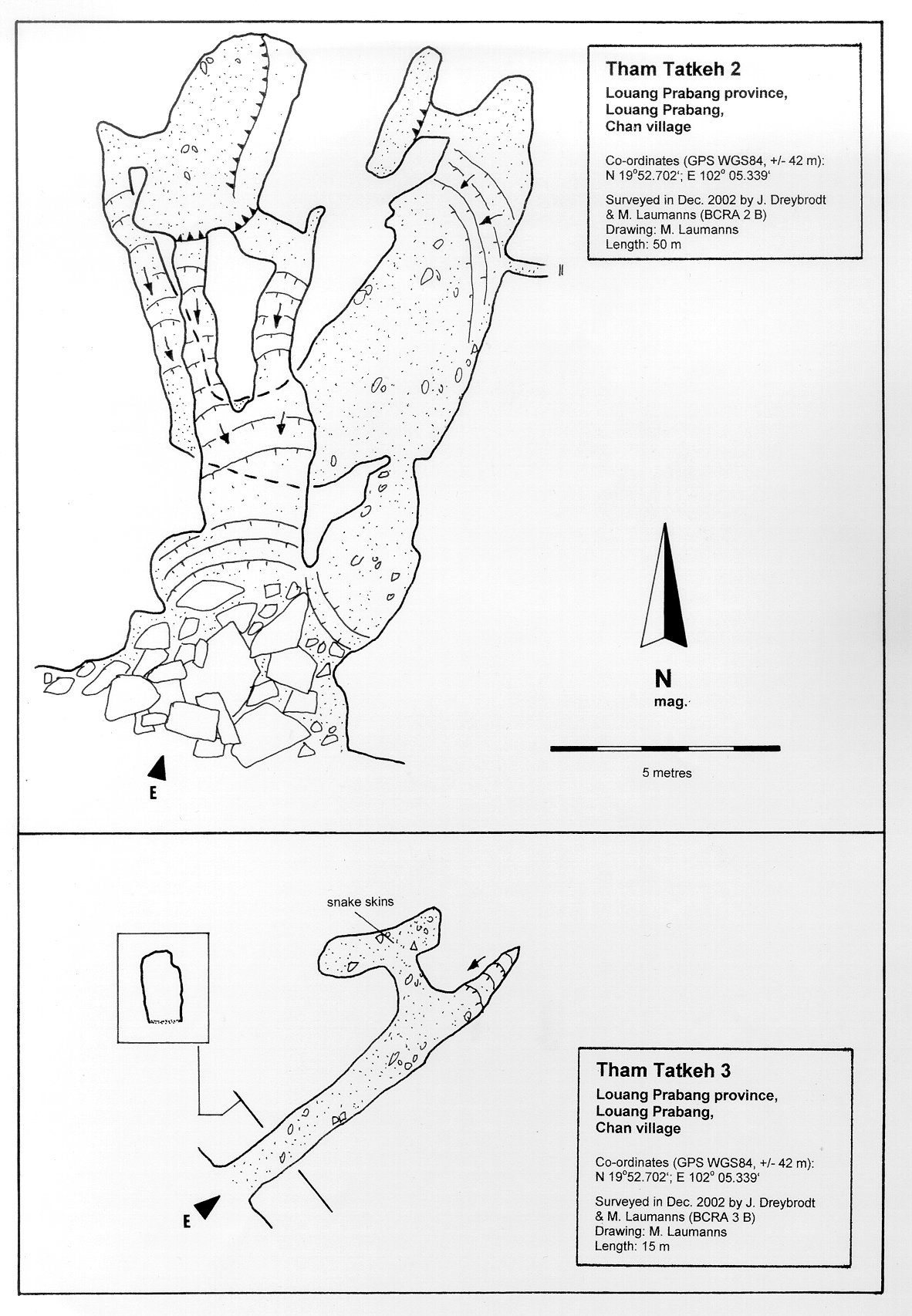
An isolated hill on the north shore of the Mekong river is situated between Cham Hua (Chomngoua) and Luang Phrabang. The moderately high limestone hill hosts three caves. Tham Tatkeh 3 is situated near Tham Tatkeh 2 in the upstream direction of the Mekong [5158] Map sheet: E48-001 Methode: GPS
Description
DREYBRODT JOERG
Cave description: Citation: ? Analysis: [5158]: The small cave consists of a short rift-controlled passage with a low side chamber where snake skins were found >> survey >> shown on map Equipment: Remarks: No. 6 in map Jörg Dreybrodt slightly moved, given position is in the river References: [4846]: Dreybrodt, J. & Laumanns, M. 2003: Der unbekannte Norden von Laos - Ergebnisse eines Erkundungsprojekts. Mitt. Verb. Dt. Höhlen- und Karstforsch. 49 (2): 38-41. [4847]: Dreybrodt, J. & Laumanns, M. 2003: Northern Laos Christmas 2002. Expedition to Muang Ngoy & Luang Prabang, Lao PDR. Unpublished Report, 20pp. [5158]: Dreybrodt, J. & Laumanns, M. (eds.) 2005: The unknown North of Laos (Karst and Caves of the Provinces Luang Phrabang and Luang Nam Tha). Berliner Höhlenkundliche Berichte 16. 105 pp & Annex.
Cavités proche
| Distance (km) | Nom | Longueur (m) | Profondeur (m) |
|---|---|---|---|
| 0.0 | Tatkeh (Tham) | 0 | |
| 0.0 | Tatkeh 2 (Tham) | 0 | |
| 1.3 | Din (Tham) | 0 | |
| 5.1 | Phousi (Tham) | 0 | |
| 6.0 | Khou Ha Sackalin (Tham) | 0 | |
| 6.6 | Thiep (Tham) | 0 | |
| 7.3 | Dok Boa (Tham) | 0 | |
| 7.4 | Kok Mu (Tham) | 29 | |
| 7.8 | Luang (Tham) | 0 |