Mor (Tham) [LA0065]
19.112259,99.571779
Location
From Wang Nuea take the H1035 south for 3.5 km to Ban Huai Khoi. Tham Phra Ngam is inconspicuously signed in Thai to the west. The side road leads to Ban Mae Phrik with occasional signs to Tham Phra Ngam. From Ban Mae Phrik head westwards and continue where the sealed road becomes a dirt track and reach Wat Tham Phra Ngam. Turn left at the gate to the wat, back onto a dirt track and follow this up the valley to the national park ranger station. Tham Mor is signposted as being 1.5 km to the north of the ranger station. From the ranger station head out the back across a flat area to a bridge over a storm gully. From here the footpath ascends, a one point following what appears to be an old cart track, up to the cave entrance which is about 500 meters from the ranger station.
Description
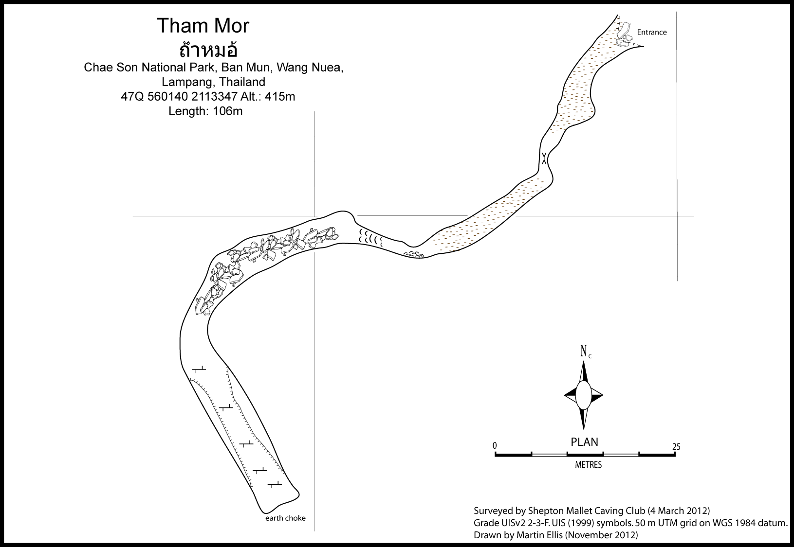
Topographie
SMCC March 2012 - Grade UISv2 2-2-A Ellis, Martin (2018)
Brief description
The cave is 100 meters of subhorizontal relict cave that ends at a complete mud blockage. This may be close to the hillside as the cave loops round. It appears to that one time a lot of the cave was filled with red earth and that his has been washed or mined away.
Documents
[Topo] Tham Mor 30/04/2019Bibliography 06/12/2019
- ***Ellis, Martin (2018) "Some caves in Thailand Part 5" Shepton Mallet Caving Club Journal Series 13 No. 7 pp299-323
Cavités proche
| Distance (km) | Nom | Longueur (m) | Profondeur (m) |
|---|---|---|---|
| 0.5 | Tham Luk Kae - LA0067 | 306 | 5 |
| 0.6 | Tham Pha Ngam - LA0054 | 1578 | 41 |
| 0.6 | Luang (Tham) [LA0066] | 226 | 8 |
| 2.0 | Sink LA0082 | ||
| 3.0 | Sink LA0083 | ||
| 13.6 | Ban Pong Tham - LA0019 | ||
| 23.6 | Tham Pha Cho - LA0048 | 75 | 5 |
| 27.6 | Ban Pa Kha Sink [LA0078] | ||
| 37.8 | Tham Nang Phaya Pang Din Fai - LA0049 |