Tham Nam Dan - NA0045
19.418510,101.062508
Location
From the Security Development Project take the road south into the doline. Before the bend to the left take a track on the right which contours round, past two small depressions and through an orchard to drop down onto the floor of the doline. Cross the doline and look for a large boulder at the edge of the field. An indistinct path goes up the slope to the right of the boulder for about 30 m ascent to the entrance at the foot of the cliff.
Description
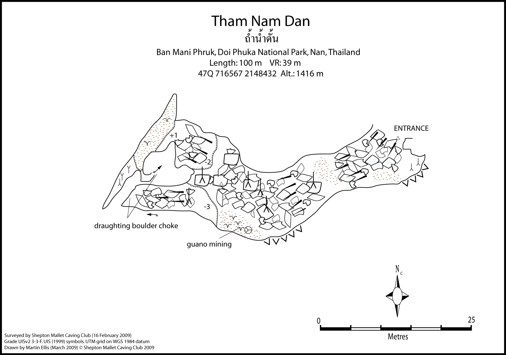
Tham Nam Dan is a steeply descending (45¦) boulder floored passage which is 15m to 20m wide. Unfortunately after 100m the passage becomes choked with boulders and earth. Although a draught was noticed between the boulders at the end of the cave all ways on were very small.
Topographie
Surveyed by SMCC February 2009 - Grade UISv2 3-3-F Survey notes PDF:- NA0045 Tham Nam Dan - Feb 2009 ELLIS, MARTIN (2009b) ELLIS, MARTIN (2010c)
Documents
[Topo] Tham Nam Dan 14/05/2019Bibliography 12/09/2020
- BOLGER, TERRY; ELLIS, MARTIN (2009) "Tham Pha Phueng" Caves Australia No. 178 September 2009 pp12-16 CAMPBELL, JO (2009) "Breaking the Thai Depth Record" presentation at Hidden Earth 2009 ELLIS, MARTIN (2005) "Some Caves in Thailand Part 1" Shepton Mallet Caving Club Journal Series 11 No. 7 pp294-321 ELLIS, MARTIN (2009b) "Ban Mani Phruk Expedition 2009" Shepton Mallet Caving Club www.lulu.com/content/7704965 ELLIS, MARTIN (2010a) "Thailand's Deepest Cave Now Even Deeper" www.thailandcaves.shepton.org.uk/nan-expedition-20… ELLIS, MARTIN (2010c) "Ban Mani Phruk Expeditions 2009 & 2010" Shepton Mallet Caving Club www.lulu.com/product/paperback/ban-mani-phruk-expe… 45pp Ellis, Martin (2011d) "Ban Mani Phruk Expeditions 2009 & 2010" Shepton Mallet Caving Club Journal Series 12 No. 7 pp342-369 Ellis, Martin (2015d) "Caves of Doi Phuka National Park" privately published, April 2015, 81pp
Cavités proche
| Distance (km) | Nom | Longueur (m) | Profondeur (m) |
|---|---|---|---|
| 0.1 | Huai Nam Dan Sink - NA0046 | ||
| 0.2 | Shaft NA0071 - NA0071 | 26 | 20 |
| 0.6 | Shaft NA0070 - NA0070 | 8 | 8 |
| 0.8 | Sink NA0101 | ||
| 0.8 | Cave NA0100 | 14 | 326 |
| 0.8 | Sink NA0099 | ||
| 0.9 | Sink NA0098 | ||
| 0.9 | Cave NA0141 | 105 | 7 |
| 1.0 | Sink NA0102 |