Ninga Cupicua
(Cheringoma - MZ - Mozambique)
-18.563889,34.866667
-18.563889,34.866667
Length 4m
Description
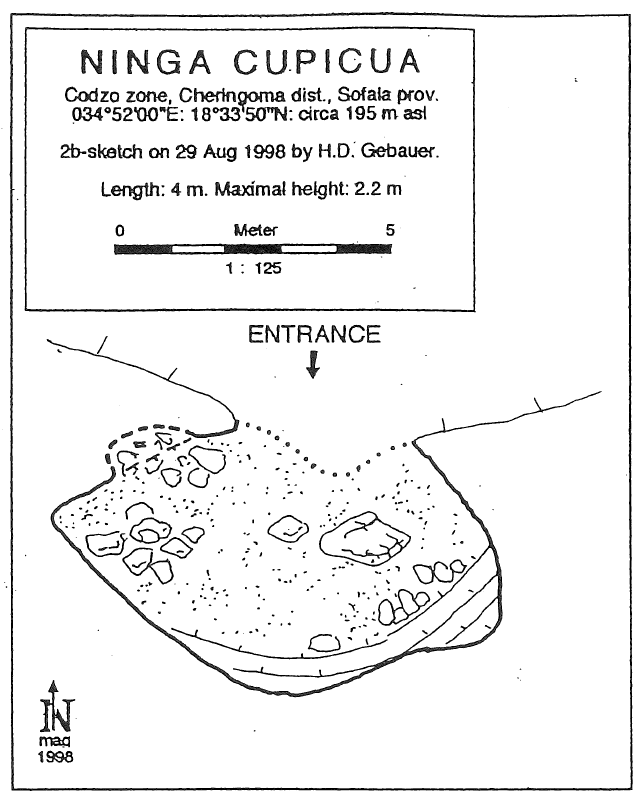
Codzo village, Codzo zone, Cheringoma district, Sofala province, 34°52'00'’E: 18°33'50"N (GPS WGS84), ca. 195 m asl. Surveyed on 29 Aug. 1998 by Herbert Daniel Gebauer (BCRA-Grade 2b). Length: 4 m. This small rock shelter is situated about 50 m NW of the northern entrance of Codzo River Cave in the border of a steep tributary dry valley. It was used by the locals to hide cereal and food during war times. A fire place was noticed. Although Ninga Cupicua does not contain significant sediments it may be an interesting place for archaeological investigations because steadily flowing water is nearby.
Caves nearby
| Distance (km) | Name | Length (m) | Depth (m) |
|---|---|---|---|
| 0.0 | Upper Codzo River Cave | 40 | |
| 0.0 | Mazamba Valley Caves | ||
| 0.1 | Codzo River Cave [Grotte de la Rivière Codzo] | 942 | 33 |
| 0.3 | Ninga Niamabawa | 130 | 10 |
| 1.5 | Eastern Codzo Cave | 156 | 22 |
| 2.0 | Smaller Eastern Codzo Cave | 40 | 10 |
| 2.1 | Western Codzo Cave | 612 | 33 |
| 6.1 | Ninga Miriango | 610 | 10 |
| 7.6 | Ninga Manguenje | 188 | 10 |