Louang (Tham)
20.775833,102.647670
Location
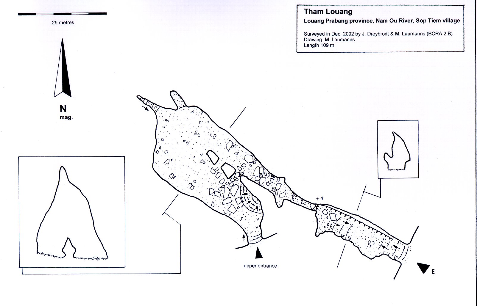
Tham Louang is situated opposite the village of Sop Chem on the west side of the Nam Ou River. The cave can be reached after a steep 15 minute walk through the jungle from the river. The entrance is 5 m wide and 10 m high and is on the opposite side of Tham Paho [5158] Map sheet: F48-110 Methode: from map
Description
DREYBRODT JOERG informations
Cave description: ? Citation: ? Analysis: [5158]: The entrance passage follows a SE-NW directed rift that continues after a 4 m climb on a higher level into a large chamber (40 m long, 20 m wide and 25 m high). From here a parallel rift leads back to a second upper entrance. The survey is only a BCRA grade 2 B, as the exploration team was not officially allowed to survey the cave. No special features >> survey >> shown on map Equipment: Remarks: References: [4846]: Dreybrodt, J. & Laumanns, M. 2003: Der unbekannte Norden von Laos - Ergebnisse eines Erkundungsprojekts. Mitt. Verb. Dt. Höhlen- und Karstforsch. 49 (2): 38-41. [4847]: Dreybrodt, J. & Laumanns, M. 2003: Northern Laos Christmas 2002. Expedition to Muang Ngoy & Luang Prabang, Lao PDR. Unpublished Report, 20pp. [5158]: Dreybrodt, J. & Laumanns, M. (eds.) 2005: The unknown North of Laos (Karst and Caves of the Provinces Luang Phrabang and Luang Nam Tha). Berliner Höhlenkundliche Berichte 16. 105 pp & Annex.
Caves nearby
| Distance (km) | Name | Length (m) | Depth (m) |
|---|---|---|---|
| 0.4 | Paman (Tham) | 0 | |
| 0.5 | Paho 1 (Tham) | 0 | |
| 0.5 | Paho 2 (Tham) | 0 | |
| 0.6 | Tham Viet | 0 | |
| 0.7 | Tham Paho 3 | 0 | |
| 1.0 | Hoengu (Tham) | 0 | |
| 2.0 | Tham Doun Mai | 0 | |
| 2.3 | Doun (Tham) [Ban Ngoy Nua] | 0 | |
| 3.0 | Grand Arbre (Trou du) | 0 |